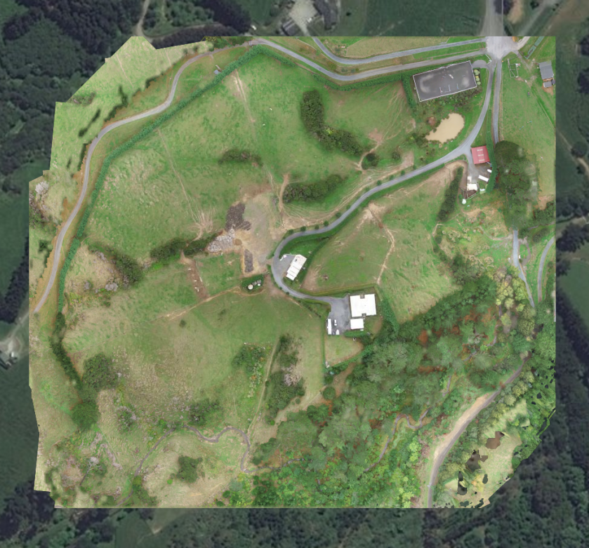
My cousin and I went and took aerial footage from his valley where they live. We created a 3D model with his drone and the sensor that is built into it. The program that allowed us to view and the 3D model was called 3D Mapping. this was the process of creating a virtual environment in response to the idea of preserving artifacts and environments I set out to argue in my research document.